Edge AI for flood monitoring: seeing the event, not just the number
Why we put the intelligence on the device, and what it means for sites where the network is the first thing to fail.
A water level reading is a number. A control room operator reading that number at 3 a.m. has to decide whether to act on it. Is the river really rising fast? Is a sensor reading wrong? Has debris blocked the channel?
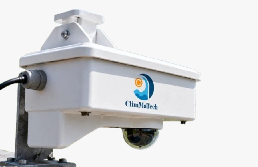
Radar tells you precisely how much. It does not tell you what is happening. That is the gap Doordrishti is built to close, by pairing radar measurement with a camera and an AI engine that runs on the device itself.
Three sensors in one unit
Doordrishti combines:
- A level radar: 61 GHz FMCW radar, 0 to 30 m, ± 1 mm.
- A velocity radar: 24 GHz Doppler radar for surface velocity, 0.02 to 20 m/s, ± 1 to 2% of the measured value.
- A Full HD camera: AI-enabled, with a 2.8 to 12 mm varifocal lens (about 120° horizontal field of view), suited to river or drain widths up to 20 m.
Everything runs from one solar-powered unit that draws under 4 W when active, so it can be installed where there is no mains supply.
Why the AI runs on the device
Most of the places we monitor have unreliable networks. Remote river sections, mountain valleys and flooded roads are exactly where mobile coverage drops during a storm, which is exactly when you most need the monitoring to keep working.
If the AI lived in the cloud, a lost connection would mean lost detection. So the engine runs on the device:
- Event detection works without a network or cloud connection.
- When an event is detected, the camera captures images of it.
- Results and images are sent to the cloud when a connection is available.
Events you choose
The AI engine is configurable for each site. Examples of what it can be set up to watch for include rapid water-level rise, abnormal flow, debris and bank changes. A river in a steep catchment has different risks from a city drain or a reservoir spillway, so we set it up for the events that matter at your site, instead of applying one rule everywhere.
Verify before you act
The practical benefit is trust. When an alert arrives, the operator sees a picture of the event next to the radar data. A false reading is easy to spot. A real rise is easy to confirm. Either way, the decision to warn people is based on evidence, not on a number alone.
| Question | Radar alone | Radar with camera and edge AI |
|---|---|---|
| How high is the water? | Yes, to ± 1 mm | Yes |
| How fast is it moving? | Yes, directly | Yes, and cross-checked by the camera |
| What caused the change? | No | An image of the event |
| Does it still work with no network? | Measurements, if logged | Detection and image capture on the device |
Two ways to measure speed, checked against each other
The camera also estimates surface velocity from the video, using optical flow, over a range of 0.02 to 5 m/s. That estimate is compared with what the Doppler radar measures directly. When the two agree, you can trust the reading more. When they do not, it is a prompt to look closer.
The device also self-calibrates, so it holds its precision without frequent manual visits to the site.
Where it fits
Doordrishti suits places where understanding an event matters as much as measuring it: flash flood warning points, dam and reservoir sites, and urban drains and underpasses. It connects over GSM (2G / 3G / 4G), LoRa, Wi-Fi, Ethernet, RS-485 and MODBUS, and sends data to the ClimMaTech cloud.
It has a weatherproof enclosure and an operating range of -40°C to +70°C.
See the full specifications on the Doordrishti page, or tell us what you need to detect at your site.