
Why surface velocity matters as much as water level
A river's height tells you how much water there is. Its speed tells you how soon it will arrive.
Imagine two rivers, both at the same height on the gauge. One is a slow, wide channel. The other is fast and turbulent. The water level reading is identical, but the situations are completely different.
Water level tells you how much water is in the channel. Water velocity tells you how quickly that water is moving, and so how quickly it will reach someone further downstream.
What each measurement tells you
| Measurement | What it answers | Why it matters |
|---|---|---|
| Water level | How high is the river now? | Compare against thresholds and past events |
| Surface velocity | How fast is it moving? | Estimate how soon a rise upstream will arrive downstream |
| Both together | How much water is passing, and how fast is that changing? | A fuller picture for forecasting and warnings |
Hydrologists estimate how much water a river carries (its discharge) from the cross-section of the channel and the speed of the flow. The level gives the first, the velocity gives the second. You need a survey of the cross-section and a site-specific factor to turn a surface speed into an average speed, but without a velocity reading there is nothing to apply them to.
How to measure river surface velocity without touching the water
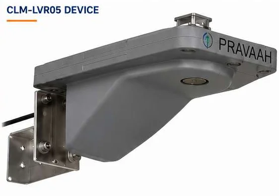
Pravaah does this with radar, from above, the same way it measures level.
- A 61 GHz FMCW radar measures the water level.
- A 24 GHz Doppler radar measures surface velocity. Doppler radar works from the shift in frequency of a signal bouncing off a moving surface: the faster the surface moves, the bigger the shift.
Both radars run from one controller, mounted above the river, for example on a bridge. Nothing sits in the water, so floods and debris do not damage the sensing elements.
The level radar has a range of 0 to 50 m (customisable) with ± 1 mm accuracy.
Why this helps early warning
A single level reading tells you a river is rising. A level reading together with a velocity reading tells you how fast the rise is travelling. If you place a Pravaah upstream of a community, the readings give you a better basis for deciding when a warning should go out, and how much time people have.
This is how the lead time of a flood warning is built. We describe that chain from sensor to siren in How a flood early warning system works.
Practical details
- Power: a solar panel (40 to 60 W) with a LiFePO4 battery and MPPT charge controller. Average consumption is under 2.5 W, so it works at remote, off-grid sites.
- Connectivity: GSM (2G / 3G / 4G), LoRa, Wi-Fi and Ethernet, with NB-IoT and VSAT as options.
- Alerts: when a threshold is crossed, alerts go out by WhatsApp, SMS and email.
- Remote management: secure remote configuration, diagnostics and over-the-air updates.
- Environment: a weatherproof enclosure and an operating range of -40°C to +70°C.
You can see where Pravaah fits in a complete system on our river monitoring page.